Loading
Source: Aerospace America
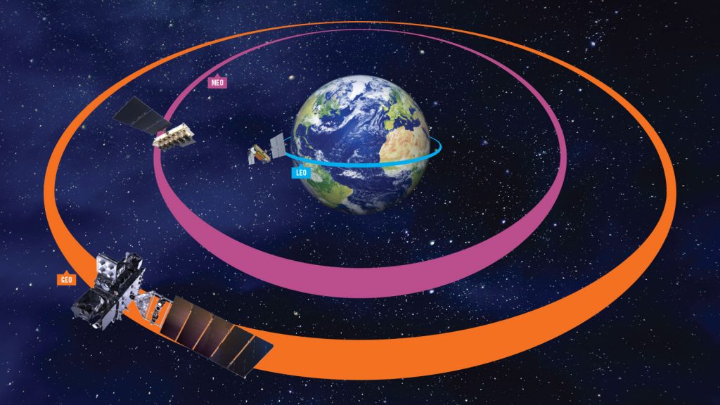
Satellites in Low Earth orbit (LEO) and Medium Earth orbit (MEO) are often deployed in a constellation. They provide continuous coverage over a small area as they move around the Earth. For various applications, such as digital connectivity, satellites in low Earth orbit provide better coverage and lower path losses than using a geostationary satellite. Examples of satellite constellations include GPS and Galileo for navigation and geodesy and other applications such as disaster monitoring and communication. Some of these include the Satellite Data Services and OneWeb constellation.
Low-Earth Orbit satellites are among the latest innovations in the satellite industry, which provides better signal coverage to the unconnected parts of the Earth. Due to their location, they are positioned lower in Earth's orbit than any other satellite. They are also known to be closer to the Earth's surface than geostationary ones. They can reach an altitude of around 800 to 1600 kilometers.
But, why is being closer to the surface of the earth a good thing?
– Higher speed & lower latency (average of only 0.05 seconds)
– More stable connection with less interference (as communications must travel shorter distances)
– Much lower cost to launch due to the shorter trip and their small stature (cheap and fast to manufacture by comparison)

Source: X2nSat
LEO satellites can cover areas north or south of the equator. Due to the small size of the LEO satellites, the constellations work together to ensure full coverage of the Earth and access to the Pacific or polar regions that current GEO satellites cannot reach.
In addition to providing greater coverage, LEO satellites orbit the Earth faster, completing a full rotation every 93 minutes (about 16 cycles per day). Due to the speed of the satellites, they can only be viewed for a few minutes, so the information within each satellite must be passed on to the next to ensure a stable connection to users on Earth.
LEO opens up the opportunity to extend connectivity into hard-to-reach areas, making it ideal for the following markets:
Aviation – Commercial and Business Flights
Maritime – shipping, commercial fishing
Search and rescue operations
Utilities – including wind farms and hydroelectric power plants
Offshore – Oil Rigs
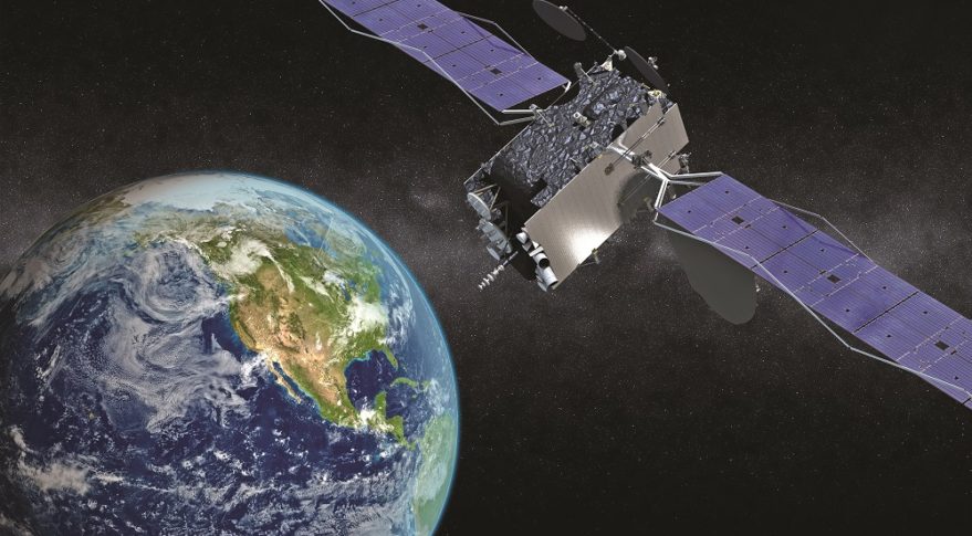
Geostationary orbit (GEO) satellites have been around for more than 50 years, first launched for communications in 1964 in NASA’s Syncom III experiment, providing global television coverage of the Tokyo Summer Olympics. Since then, GEO satellites have been used for many everyday communications such as the weather forecast we see on TV.
However, as innovations such as LEO satellites continue, will GEO be as reliant as ever? How do GEO satellites work?
GEO satellites differ from LEO in many ways. The GEO satellites orbit about 35,000 kilometers (22,000 miles) above Earth’s surface and are said to “hover” somewhere above the equator. In this very high orbit, the satellite rotates at the same speed as the Earth, i.e. completes a full rotation at the same time as the Earth. This took an average of 23 hours, 56 minutes, and 4 seconds, making it easier to receive trays on the ground. Because the satellite stays in one location, the antenna doesn’t have to move to track it across the sky.
Source: SpaceNews
Unlike LEO, GEO can only cover a specific area of the Earth, which includes every 70 degrees of latitude above or below the Earth’s equator. Due to the curvature of the earth, geostationary satellites cannot reach areas to the north or south, especially the polar regions of the earth.
The cost and time to manufacture and launch satellites in GEO are much higher than in LEO satellites.
However, due to the size of a GEO satellite, each satellite covers a larger area, which means less is required to provide coverage for a given area, and only 3 satellites are required to provide full communication coverage.
– Due to pace, technicians have up to 20 minutes to perform troubleshoots
– Many satellites are needed to cover one area
– Ground stations are complex due to the multitude of LEO satellites
– 5-8 year life span
– Coverage to just 42% of the Earth
– Higher latency, limiting their use
– Most expensive type of satellite to produce
– 10-year life span
Although LEO and GEO are diametrically opposed in altitude, both aim to provide Internet access to specific areas around the world.
Don’t miss our next blog for another satellite topic where we’ll discuss the future of connectivity in the aviation industry in the near future!
TRAVELER’S MICRO-MOMENTS Home Capturing the Traveler's Micro-Moments 26 April 2022 microMoments, Technology, traveler Time Is No Longer Measured in Days,…
IFE TO THE RESCUE Home WHEN IFE COMES TO THE RESCUE OF FLIGHT ATTENDANTS! 25 June 2022 Digital Services, IFE,…
Digital AD: IVT-FREE Zone Home DIGITAL INFLIGHT ADVERTISING: AN IVT-FREE ZONE 20 May 2022 Advertising, IVTFREE, Technology In late 2015,…